BackHomepage
  • Twitter
  • Facebook
  • linkedin
  • Instagram
  • Medium

Climate hazards and its Impacts

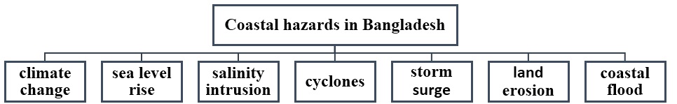
Climate hazards in Bangladesh


Coastal zone of Bangladesh is geomorphologically and hydrologically dominated by the Ganges Brahmaputra Meghna (GBM) river system and Bay of Bengal. The central coastal zone of Bangladesh is ecologically more sensitive and 
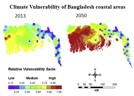
geomorphologically active. This zone is being continually attacked by cyclones, sea level rise, storm surge which have caused terrible impacts on this low lying coastal area. On the other hand, the coastal ecosystems provide a wide range of ecosystem services and benefits but this area is overpopulated and undeveloped .This study aims to identify Background of coastal risks of regional scale, rationality of coastal risks assessment, environmental impacts, risks potentials, quantifying vulnerability, and climate change adaptation strategies.
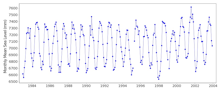
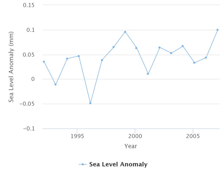
Sea level rise

Sea level rise (SLR ) along the coastline of Bangladesh is one of the major threats which may intensify the vulnerability of global climate change . SLR will cause significant impacts on wetlands and its biodiversity; water resources; agriculture, fisheries, and aquaculture; public health; displacement and migration; displacement and migration, assets(Castro Ortiz, 1994; Kibria, 2016).A 1m rise in sea level would submerge a full 18 % of the total land area in Bangladesh(Minar et al., 2013). A research showed that deeply flooded area (depth above 100 cm, duration more than 9 months) would increase by 29% (from the base year 2000) due to 88 cm SLR by 2100(CEGIS, 2006). Salinity intrusion
Increased salinity from saltwater intrusion poses an imminent threat to livelihoods and public health through its impacts on agriculture, aquaculture, infrastructure, coastal ecosystems, and the availability of freshwater for household and commercial use(Hussain, 2008). The total amount of salinity affected land in Bangladesh was 83.3 million hectares in 1973, which had been increased up to 102 million hectares in 2000 and the amount has raised to 105.6 million hectares in 2009 and continuing to increase(Mahmuduzzaman, Ahmed, Nuruzzaman, & Ahmed, 2014). With the increasing impacts of climate change, salinity intrusion gradually is going towards inland water. Coastal flooding
Coastal flood can be caused by tropical cyclone and tsunami(UNDRO., 1980) .the intensity of coastal flooding depends on height of SLR , tidal level and storm surge . Bangladesh is one of the most flood prone countries in the world due to its unique geographical location, topography and exposure to tropical cyclones. With 50% of the land less than 8 meters above sea level, and a coastline of some 600 km, coastal flooding is a common problem(“Bangladesh – Coastal Flooding Forecasts Save Lives – FloodList,” 2017).
Cyclones

Cyclone causes significant loss of lives and damage to properties, coastal infrastructures, ecosystems, and economy of Bangladesh. Coastal zone is subject to disastrous cyclone almost every years .Bangladesh is especially vulnerable to tropical cyclones with around 718,000 deaths from them in the past 50 years (Ubydul Haque, Masahiro Hashizume, Korine N Kolivras, Hans J Overgaard, Bivash Das, 2012).The Bay of Bengal is vulnerable to cyclones predominantly in the pre-monsoon months of April-May and the post-monsoon months of October- December (Sarker, 2018). A study predicted intensified tropical cyclones and associated storm surges with an increase in Sea surface temperature(Emanuel, 2005) .

.

  • Learn More
figure -1 major coastal risks in Bangladesh

figure -2 sea level rising in the coastal area of Bangladesh

figure -3 sea level anomaly in the coastal area of Bangladesh

Climate vulnerability in the coastal area of Bangladesh

Bangladesh is the second most vulnerable country to climate change among the 27 most vulnerable countries due to its dense population in the coastal zone and low economic condition(Parry, M., et al., 2007). Coastal risks are mainly climate change, sea level rise, salinity intrusion, cyclone, storm surge, land erosion and coastal flooding. Most of them driven by climate change..

The global climate is changing that is undisputed(Conway, Adger, Huq, & Hulme, 2015) . Climate change brings a significant coastal risks .Bangladesh is one of the countries most likely to suffer adverse impacts from anthropogenic climate change. Although Bangladesh emits less than 0.1% of global greenhouse gas emissions(Change, 2001). It is one of major coastal risks in Bangladesh because it is associated with other natural hazards in a complex way. The climatic conditions of Bangladesh are influenced by a number of global and regional scale factors. These factors include geographical location, the effect of North-South continental scale atmospheric pressure, the influence of the jet stream stretched from South East Asia to Northern Africa on the monsoon wind system, changes in the solar albedo due to land use, land cover change in the region and its impacts on wind pattern, and fluctuations in the terrestrial and sea surface temperature(Kabir, Khan, Ball, & Caldwell, 2016). This is of great concern, since the location and geography of Bangladesh makes it not only particularly susceptible to the effects of climate change, but also extremely hard to protect(Karim & Mimura, 2008). Sea level rise Sea level rise (SLR ) along the coastline of Bangladesh is one of the major threats which may intensify the vulnerability of global climate change . SLR will cause significant impacts on wetlands and its biodiversity; water resources; agriculture, fisheries, and aquaculture; public health; displacement and migration; displacement and migration, assets(Castro Ortiz, 1994; Kibria, 2016).A 1m rise in sea level would submerge a full 18 % of the total land area in Bangladesh(Minar et al., 2013). A research showed that deeply flooded area (depth above 100 cm, duration more than 9 months) would increase by 29% (from the base year 2000) due to 88 cm SLR by 2100(CEGIS, 2006).

References
  1. Ahmed, A., Drake, F., Nawaz, R., & Woulds, C. (2018). Where is the coast? Monitoring coastal land dynamics in Bangladesh: An integrated management approach using GIS and remote sensing techniques. Ocean and Coastal Management, 151(July), 10–24. https://doi.org/10.1016/j.ocecoaman.2017.10.030
  2. Amin, M. N., Solayman, H. M., Snigdha, S. S., & Sultana, J. (2018). Climate resilient livelihood activity in the south central coastal region of Bangladesh. Journal of Science Technology and Environment Informatics, 6(1), 421–430. https://doi.org/10.18801/jstei.060118.45
  3. Bangladesh – Coastal Flooding Forecasts Save Lives – FloodList. (2017). Retrieved from http://floodlist.com/asia/bangladesh-coastal-flooding-forecasts-save-lives
  4. Begum, S., & Fleming, G. (1997). Climate change and sea level rise in bangladesh, part ii: Effects. Marine Geodesy, 20(1), 55–68. https://doi.org/10.1080/01490419709388094
  5. Castro Ortiz, C. A. (1994). Sea-level rise and its impact on Bangladesh. Ocean and Coastal Management, 23(3), 249–270. https://doi.org/10.1016/0964-5691(94)90022-1
  6. CEGIS. (2006). Impact of Sea Level Rise on Land use Suitability and Adaptation Options, Center for Environmental and Geographic Information Services (CEGIS). Dhaka-1212, Bangladesh. Retrieved from http://www.cegisbd.com/
  7. Change, C. (2001). Climate Change and Bangladesh, 294(November). https://doi.org/10.1126/science.294.5547.1617

  • Learn More
figure -4 coastal vulnerability in the coastal area of Bangladesh

Get in touch

I love to work in the field of Oceanography and Data analysis.If you think, you can contact with me at any moment.

  • hafezahmad100@gmail.com
  • (+880)1785601208
  • Bangladesh
    Chittagong,Kotowali

© hafez. All rights reserved. : hafez. Design: hafez ahmad.